
 Philippines Prepares for Super Typhoon Bavi's Approach with Emergency Measures
KillBait - News highlights delivered clearly and responsibly—no clickbait, no sensationalism
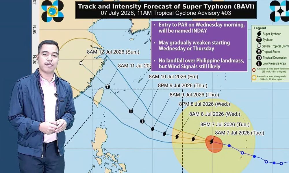
Photo: Philstar.com
2026-07-07 17:07 Current affairs 10


Super Typhoon Bavi Approaches Philippine Area of Responsibility
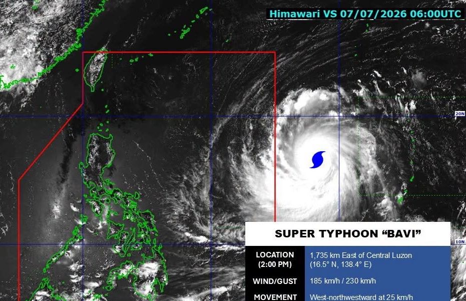
The Philippine Atmospheric, Geophysical and Astronomical Services Administration (PAGASA) has announced that Super Typhoon Bavi is expected to enter the Philippine Area of Responsibility (PAR) early Wednesday.
The typhoon, currently located far east of the Philippines, is projected to follow a path that may bring strong winds and heavy rainfall to the region.
While PAGASA has stated that Bavi is unlikely to make direct landfall, the agency has issued wind signals for areas that may experience significant impacts.The storm's movement is being closely monitored, with updates provided regularly to the public.Residents are advised to stay informed and prepare for potential weather disruptions.
The article highlights the importance of vigilance and preparedness as the typhoon approaches, emphasizing the need for community readiness and adherence to safety protocols.
Additionally, the piece notes the broader context of climate change, which has increased the frequency and intensity of such weather events, urging stakeholders to prioritize long-term resilience strategies.
2186
Original title: Super Typhoon Bavi expected to enter PAR early Wednesday
The AI system has determined that this news is not clickbait/sensationalist: : The original title is straightforward and informative, providing clear details about the typhoon's expected entry into the PAR without sensationalism. This has coincided with the opinion of the majority of users.
You may also be interested in...
Philippines Prepares for Super Typhoon Bavi's Approach with Emergency Measures
 Philippine Army Constructs Shelters for Earthquake Victims in Sarangani
 NDRRMC Prepares for Super Typhoon Bavi's Impact