
 Typhoon Bavi Threatens China and Taiwan with Potential Catastrophic Damage
KillBait - News highlights delivered clearly and responsibly—no clickbait, no sensationalism
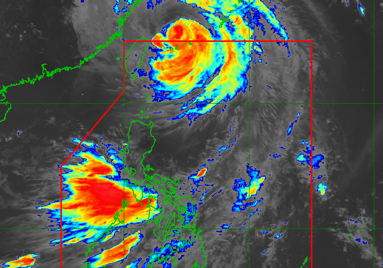
Photo: RAPPLER
2026-07-11 11:05 Environment 10


Typhoon Inday's Impact on Southwest Monsoon Persists Despite Exiting PAR
Typhoon Inday (Bavi) has exited the Philippine Area of Responsibility (PAR) but continues to influence the southwest monsoon, leading to persistent heavy rainfall and strong winds across multiple regions.
As of July 11, 2026, Inday was 590 kilometers northeast of Itbayat, moving northwest at 20 km/h with maximum sustained winds of 140 km/h and gusts up to 170 km/h.
While the typhoon no longer poses a direct threat to Batanes, the enhanced southwest monsoon remains active, triggering significant rain in over 20 provinces.
PAGASA warns of potential flooding and landslides, with heavy to intense rainfall (100-200 mm) expected in Zambales, Bataan, and Occidental Mindoro from July 11-12, and moderate to heavy rain (50-100 mm) in other regions.Coastal areas face rough seas, with waves up to 7 meters high in Batanes and 4.5 meters in mainland Cagayan.Inday is projected to weaken into a severe tropical storm over mainland China by July 12.The storm's outer bands and monsoon systems will continue affecting Luzon, Visayas, and parts of Mindanao through July 13-14.Residents are urged to stay alert for weather-related hazards and follow PAGASA advisories.
2186
Original title: Typhoon Inday out of PAR but still enhancing southwest monsoon
The AI system has determined that this news is not clickbait/sensationalist: : The original title is factual and informative, focusing on the typhoon's current status and its ongoing impact on the southwest monsoon without sensationalist language. This has coincided with the opinion of the majority of users.
You may also be interested in...
Typhoon Bavi Threatens China and Taiwan with Potential Catastrophic Damage
 Typhoon Inday Downgraded to Typhoon; PAGASA Updates on Path and Impact
 Super Typhoon Inday Shows Slight Weakening