
 Satellite imagery highlights Inday and Habagat flooding impact in BARMM
KillBait - News highlights delivered clearly and responsibly—no clickbait, no sensationalism
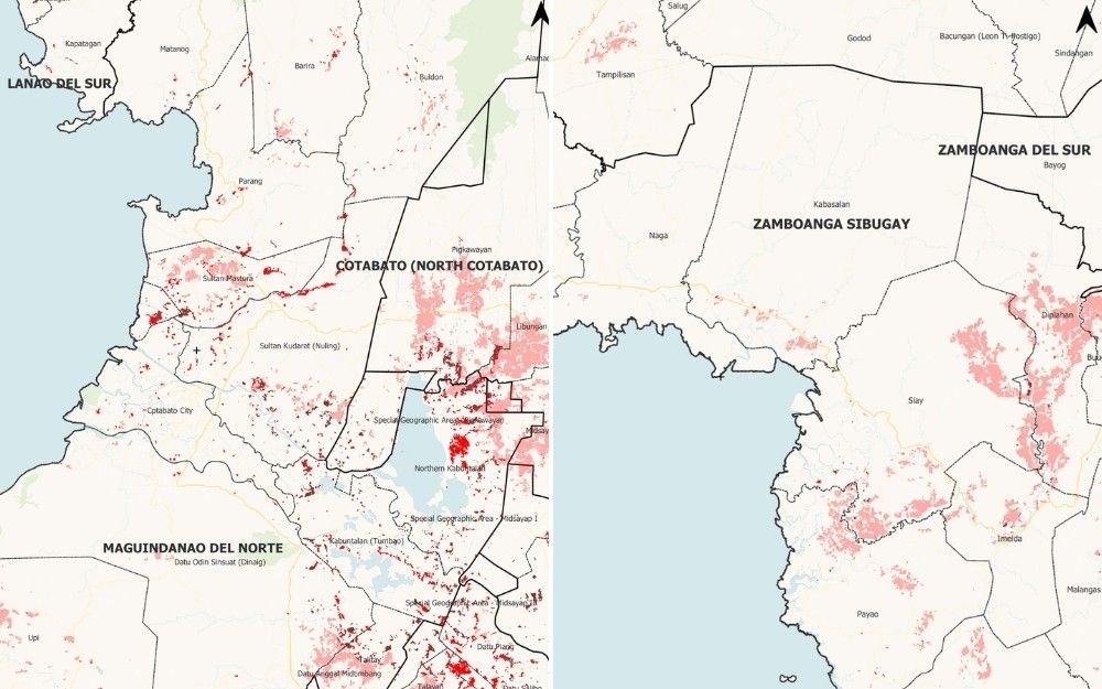
Photo: Philstar.com
2026-07-12 10:46 Environment 10


Satellite Data Reveals Severe Flooding in Mindanao After Typhoon Inday
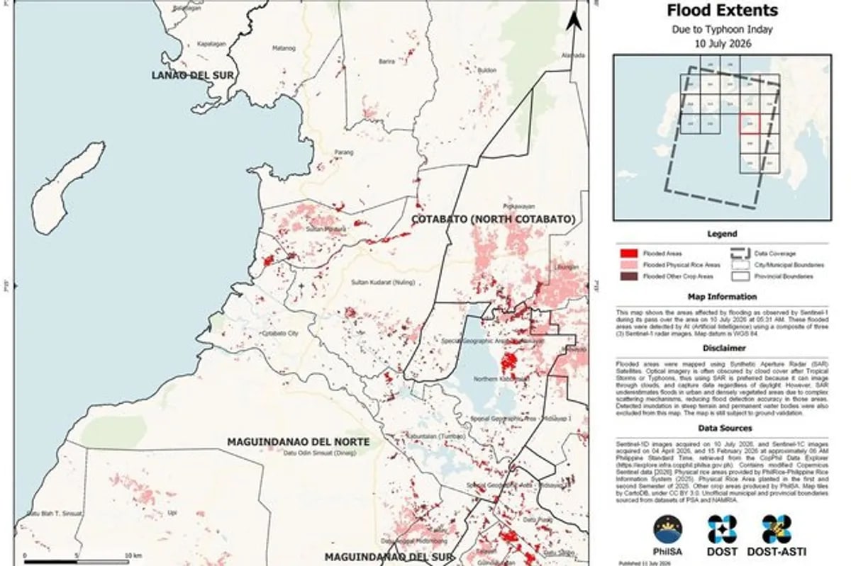
Satellite maps from the Philippine Space Agency, using Sentinel-1 data, show heavy flooding in Cotabato and Bangsamoro areas after Typhoon Inday (Bavi) hit Mindanao.The maps, captured on July 10, highlight red zones for dense flooding, pink for rice fields, and brown for other crops.The most severe flooding is in the Cotabato-Bangsamoro corridor, with clusters in Lanao del Sur and Maguindanao del Sur.PhilSA noted that urban and vegetated areas might be underestimated due to radar complexities.Over 514,000 people were affected, with 17 deaths from landslides.The data aids disaster management efforts, though ground validation is needed.Agricultural areas like Lanao del Norte and Zamboanga del Sur also show widespread inundation, impacting rice production.The analysis supports the National Disaster Risk Reduction Council in prioritizing responses.
2187
Original title: Where Inday-linked flooding appears heaviest, based on space data
The AI system has determined that this news is not clickbait/sensationalist: : The original title is factual and directly references the satellite data, avoiding sensationalist language. This has coincided with the opinion of the majority of users.
You may also be interested in...
Satellite imagery highlights Inday and Habagat flooding impact in BARMM
 Severe Flooding in Occidental Mindoro Due to Enhanced Monsoon Rains
 Typhoon Inday's Impact on Southwest Monsoon Persists Despite Exiting PAR